Making Geography More Accessible Through Touch
Saswati Paik is using tactile models and low-cost teaching materials to make geography classrooms inclusive for visually impaired learners.
Saswati Paik has spent years teaching a geography unit to batches of MA in Education students, many of whom go on to work as teachers, teacher educators, and curriculum developers. The majority of her students have studied geography only up to grade X and arrive with limited exposure to the subject.
In the early years, this posed a consistent challenge to Saswati, who sees geography as a tool to make sense of the natural and social world around us. “The students come in saying geography is a boring subject. It would pain me to hear that,” she says.
Saswati uses the course to change these perceptions by helping students develop their understanding of geography and the pedagogical skills needed to teach the subject effectively. As part of their field practice, students spend around 12 weeks visiting schools, thereby gaining hands-on experience teaching subjects including geography. Saswati’s goal is to equip them to bring the subject alive in classrooms and inspire school children.
To make geography more engaging, she introduced a range of audio-visual aids in class. What started as an effort to spark her students’ interest in the subject eventually led in 2022 to the creation of a geography lab on campus filled with tactile learning materials. The catalyst was a partially visually impaired student who joined her class. Despite finding the subject interesting, the student struggled with the visual content in textbooks and audio-visuals used in class.
Exploring new ways of learning
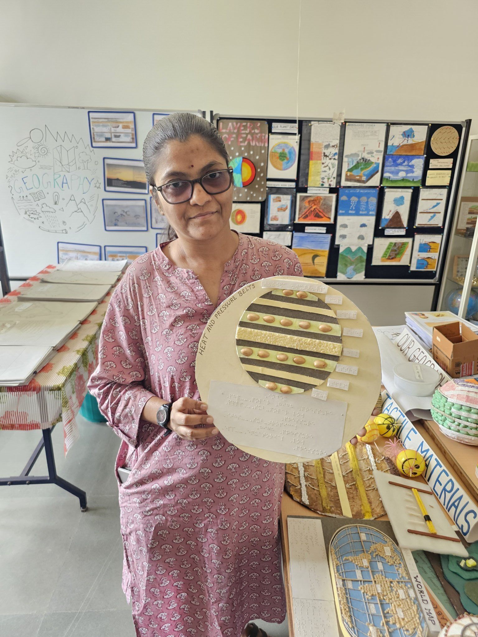
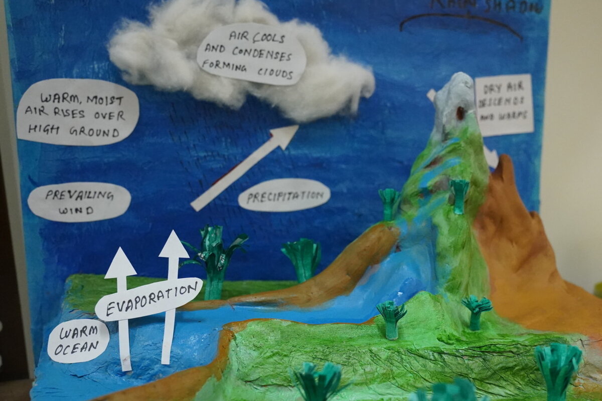
As most geographical concepts are best explained through visual means, Saswati decided to create tactile material to help the student. Her first model depicted the heat and pressure zones of the earth. This experience marked the beginning of her tactile learning journey.
“Within a few minutes of exploring the model through touch, she was able to grasp the concept. Other students engaged with the model with just as much excitement. That’s when I was convinced that such resources could benefit all geography students.”
Slowly, the classroom challenge evolved into a broader line of inquiry that transformed Saswati’s teaching and informed her research on enriching the geography experience for visually impaired children and teachers.
Understanding geography through touch
Today, the geography lab is a treasure trove of tactile learning materials. Nearly 90 percent of the teaching-learning resources in the lab are made from waste materials. The 3D models are made from papier-mâché created with old newspapers from the library, while sand collected from the university’s construction sites is used to provide texture to the displays. Everything from used plastic bottles, straws, old event posters, and even thermocol packaging finds a second life in the lab.
Saswati makes the initial prototype and her lab associate, Elwin, helps create different versions for use in teaching and training. Over the years, her students have contributed to the lab as well.
“Suman, an MA in Development student who was fully visually impaired, volunteered to give Braille labels to many of the models. Now, someone who knows Braille can learn these concepts themselves by just touching the learning aids,” she says.
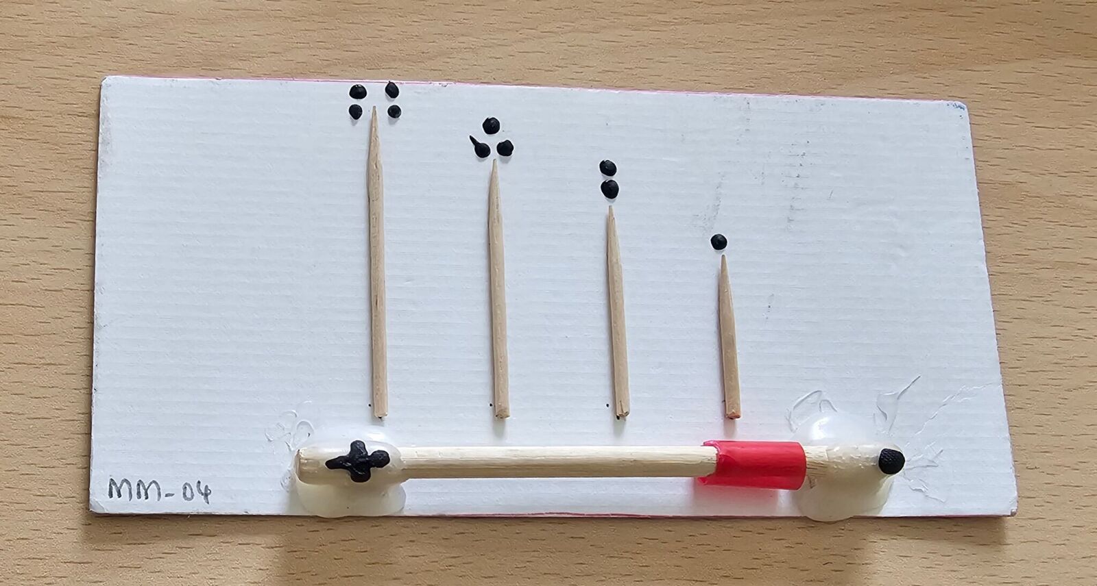
A scale card made from ice cream sticks, toothpicks, and a plastic band that helps a visually impaired person understand the concept of zooming in and out
One of Saswati’s proudest moments was when an English professor from Jadavpur University, who is fully visually impaired, visited the lab and excitedly told her that he would have taken up geography if he had a teacher like her.
Mapping Absolute Inclusion: The Lab that’s Transforming Geography Education →
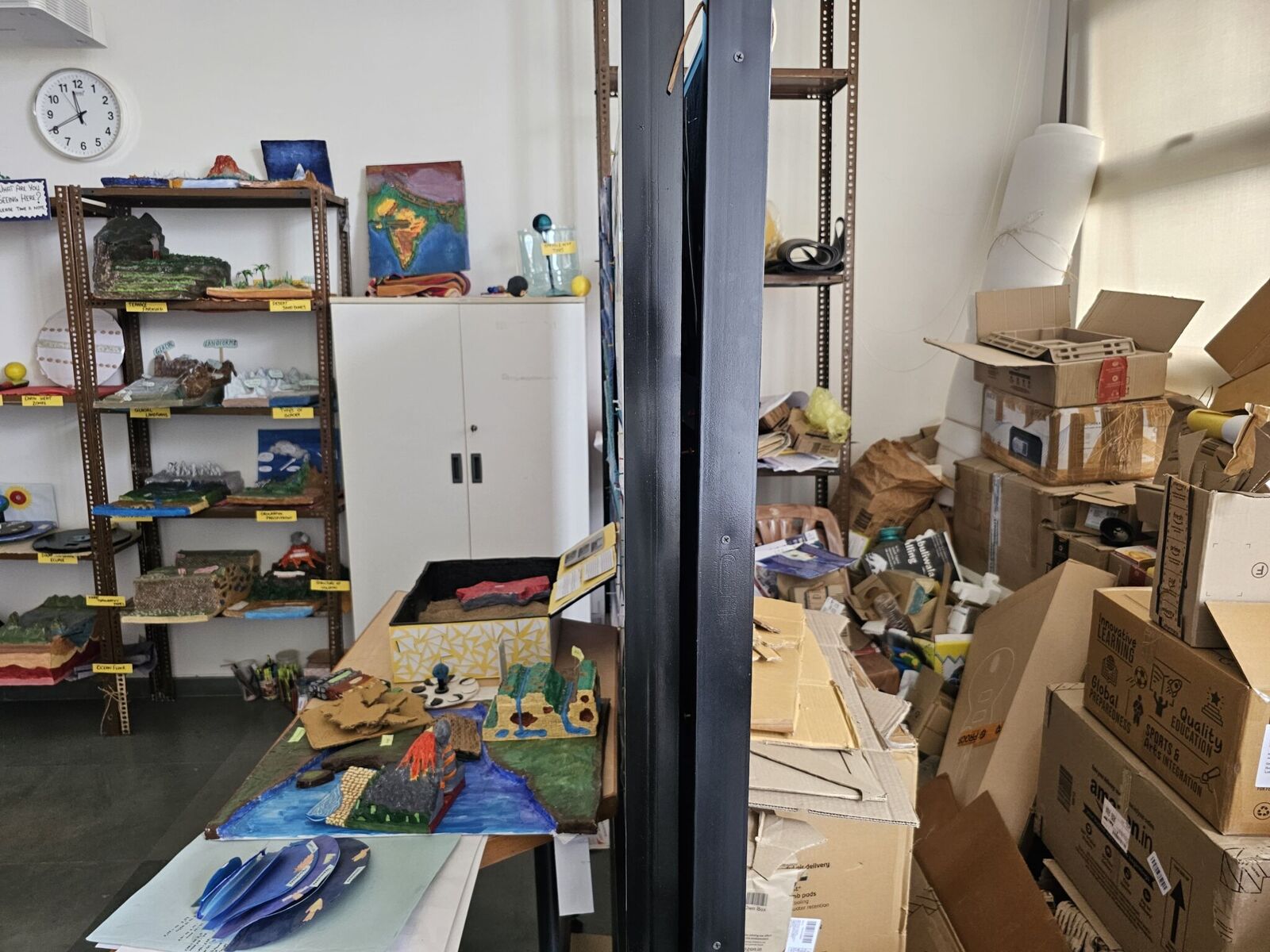
The ‘kabaadi area’ on the right is where discarded material is stored until inspiration strikes
The National Education Policy 2020, a comprehensive framework for educational reform, calls for greater focus on experiential pedagogy. In this context, experts argue that geography education must move beyond textbook-based teaching towards more interactive and inquiry-driven methods.
While some not-for-profit organisations have made efforts to improve access to STEM education for visually impaired students, Saswati feels geography is still underexplored.
“The embossed maps and Braille books available in the market are expensive, especially for government schools. Teachers also need the right training and continued support to successfully adopt innovative teaching practices.”
“I would like to see geography become an option for everyone, including visually impaired children, in the next 5 – 10 years. I would also like to see more teachers trained and supported to make geography classrooms inclusive.”
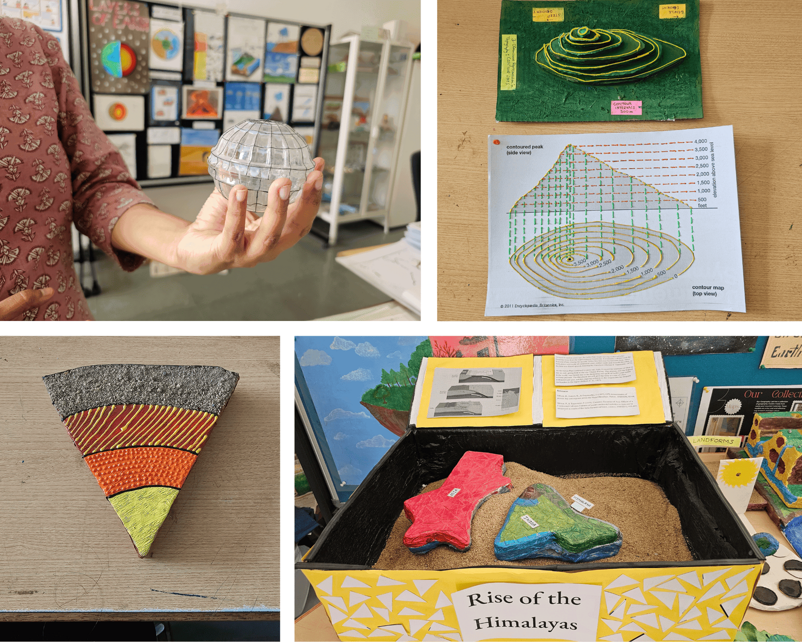
Clockwise from top left: A globe representing latitude and longitude; a tactile contour map; Elwin’s model on the formation of the Himalayas; a model of the earth’s interior layers
Saswati is currently working on a research project with the not-for-profit organisation Vision Empower and International Institute of Information Technology Bangalore to develop teaching-learning materials to make geography accessible for visually impaired school students from grades VI‑X. This involves creating a guided module for teachers with a kit with tactile material and instructions on presenting geography concepts in an inclusive way. The kit is designed across three themes — maps, Earth’s interior, and land forms.
Saswati has stayed true to her zero waste philosophy, ensuring that the teaching-learning materials for the project are all made with discarded materials.
Her daughter’s old ball has been turned into a globe, with a thread serving as a tactile clue to help students understand the equator. Two juice glass covers have been fused together into a globe and ridges have been made with threads to represent the latitudinal and longitudinal lines.
As part of the collaboration, the map-themed guided module is now being implemented across three schools in Karnataka, Kerala and West Bengal. For some of the students with visual impairments, the tactile learning material provided their first real introduction to the concept of maps.
A lot of thought has gone into designing the resources so that the students are not overwhelmed with too much information at once. While one map depicts India’s land boundaries, another represents the neighbouring countries. These individual maps help the students engage with one concept at a time while gradually building a broader understanding.
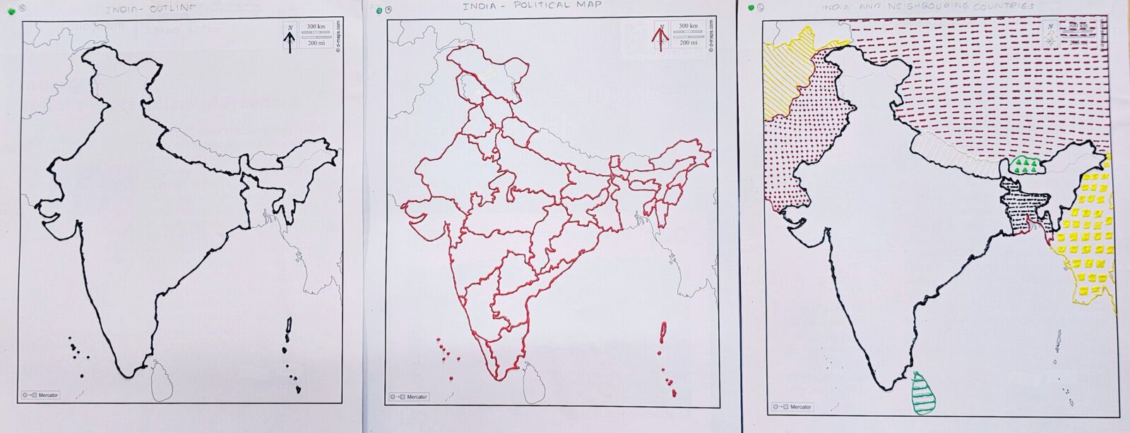
From left to right: Tactile maps depicting India’s land border; the states; neighbouring countries.
Today, geography is not generally offered beyond grade X to children with visual impairments, limiting their ability to pursue the subject at the undergraduate and postgraduate levels. Saswati hopes her research can help change the status quo.
“I would like to see geography become an option for everyone, including visually impaired children, in the next 5 – 10 years. I would also like to see more teachers trained and supported to make geography classrooms inclusive.”
About the author
Meryl Garcia is a consultant with Azim Premji University’s Research Centre. She spends her time exploring research projects across the social sciences and uncovering the stories hidden within them.
Image credits: Meryl Garcia
Cover image: Saswati with her first model made from cake base. The equatorial band is represented with rice, while alternating textures of pista shells and double edged tape are used to distinguish the high and low pressure zones.